How Pressure Gradient Windstorms Work

A pressure-gradient windstorm makes distinct markings in autumn leaves, demonstrating
eddy currents of air in two distinct positions near cylindrical obstacles. Winds were near 40 MPH.
Image By: Justin Reid 11/13/2006
Pressure-Gradient windstorms are one of the most common Autumn/Winter weather effects of our region. Formed from when a Nor'Easter and a strong high pressure or a strong Nor'Easter and weak high pressure, form a giant pressure difference between the two systems. This can create what I call "The Tropical Storms of the Mainland". These windstorms that form from this event can be well over 40 MPH in wind speed, which is tropical storm strength wind on the Saffir-Simpson Hurricane Scale. I have remembered these windstorms for a long time, but how did they necessarily work. I went on a journey of discovery about these windstorms and how they functioned.
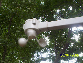
My anemometer measuring an outflow boundary during a spring thunderstorm on 6/04/2006. Image By: Justin Reid
I knew the main mechanics of this strong windstorm. A strong high or low pressure had to be paired with its inverse. I knew that the difference between the atmospheric density of the systems involved was the key to the windstorm's strength. But what governed stronger windspeeds at different times? How did these pressure-gradient windstorms ebb and flow? The answer would not come until later after a few trips to the National Weather Service.
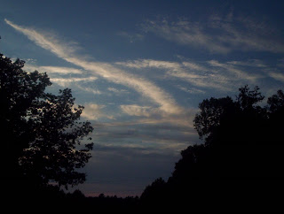
A cold front creates an amazing cirrus and stratocumulus display in the middle of July. Rare for that time of year,
this formation reminds me of several images taken in the weather guide Wind and Weather. Image by: Justin Reid 7/11/2007.
At the National Weather Service, I learned how meteorologists decipher local upper-level atmosphere conditions. From weather balloons, they make observations called "soundings" also called "thermodynamic profiles". Plotted with dew point, temperature, and wind at different levels of the atmosphere in a certain manner, it can be read to show many different conditions at the lower levels.
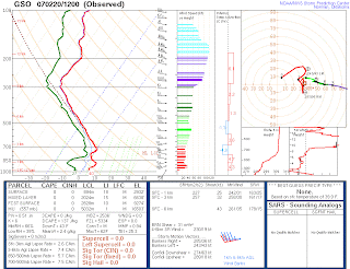
An example of an observed sounding from Greensboro, North Carolina. Note the green line denoting dew point and the red line denoting temperature. Each level in the atmosphere is denoted by pressure in millibars like in hurricanes; instead of feet or kilometers. The flags and barbs at the right denote windspeed at a certain level. Image courtesy: The Storm Prediction Center.
How do these soundings and windstorms even relate to one another? I discovered the answer with something called "the mixing level". The mixing level is a point where dew point and temperature stop following a certain rate and begin to radiate into different pathways. At this point, the moisture content (dew point) and wind speed tendencies are brought down to the surface. In pressure gradient windstorms, the wind is strong at the mixing level, around 40 MPH. There that strong wind is brought down to the surface in the event. But how does that explain why wind is stronger at different times? The answer lies in the height of the mixing level. Wind speed generally increases with height, and the mixing-level rises throughout the day. As this level rises the wind increases and the humidity drops. The mixing-level then falls again at night and decreases the wind-speed. This happens every day! In pressure-gradient windstorms however, this effect is exaggerated because of the high winds at the upper-levels of the atmosphere(humidity changes are usually the same). This explains how windstorms are stronger at certain times of the day. Sometimes, there are deviations to this pattern, but even then, it all has to do with the mixing level and the strength of the wind there that makes the windstorm stronger.
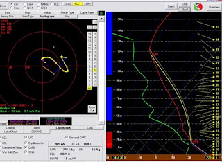
This is an image of a "forecast sounding" computer program called Bufkit. Made by the National Weather Service, this program forecasts the thermodynamic profiles used to determine the details of a pressure-gradient windstorm. The program uses several different weather models for the "forecast soundings". Some forecast soundings have a longer range, while some may be more precise. Bufkit: by the Warning and Decision Training Branch of the National Weather Service and the National Weather Service Forecast Office In Buffalo, N.Y.
This was a discovery situation for me. Learning the mechanics of a powerful windstorm is intruiging This learning process demonstrates the discovery process well and how it can be applied to scientific inquiry.
|

This is a satellite image of a pressure-gradient windstorm. These systems, also called
Northwest Flow Snow events, are one of the major sources of snowfall in the Smoky Mountains and aid in the skiing tourist industry there.


No comments:
Post a Comment